| Mali |
|
|
 |
|
| Geography | |
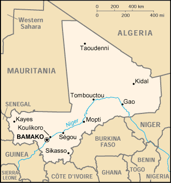
| Location: | Western Africa, southwest of Algeria. |
| Area: | total:
1,240,192 sq km land: 1,220,190 sq km water: 20,002 sq km |
| Natural Resources: | gold,
phosphates, kaolin, salt, limestone, uranium, gypsum, granite, hydropower
note: bauxite, iron ore, manganese, tin, and copper deposits are known but not exploited |
| Population and Health | |
| Population: | 16,455,903 (July 2014 est.) |
| Age structure: | 0-14 years: 47.6% (male 3,931,818/female 3,899,535) |
| Population growth rate: | 3% (2014 est.) |
| Birth rate: | 45.53 births/1,000 population (2014 est.) |
| Death rate: | 13.22 deaths/1,000 population (2014 est.) |
| Sex ratio: | at birth: 1.03 male(s)/female |
| Infant mortality rate: | total: 104.34 deaths/1,000 live births |
| Life expectancy at birth: | total population: 54.95 years |
| Total fertility rate: | 6.16 children born/woman (2014 est.) |
| Current contraceptive use among married women 15-49 years old(any method): | 8% (2007-2012) |
| Unmet need of contraceptive: | 27.6% (2006) |
| HIV/AIDS - people living with HIV/AIDS: | 100,300 (2012) |
| HIV/AIDS - deaths: | 4,900 (2012) |
| Literacy: | definition: age 15 and over can read and write |
| Economy | |
| GDP (purchasing power parity): | $18.9 billion (2013 est.) |
| GDP (official exchange rate): | $11.37 billion (2013 est.) |
| GDP - real growth rate: | 4.8% (2013 est.) |
| GDP - per capita (PPP): | $1,200 (2009 est.) |
| GDP - composition by sector: | agriculture: 38.5% |
| Labor force - by occupation: | agriculture: 80% |
| Population below poverty line: | 36.1% (2005 est.) |
| Inflation rate (consumer prices): | 0.1% (2013 est.) |
| Agriculture - products: | cotton, millet, rice, corn, vegetables, peanuts; cattle, sheep, goats |
| Industries: | food processing; construction; phosphate and gold mining |
| Exports - commodities: | cotton, gold, livestock |
| Currency (code): | Communaute Financiere Africaine franc (XOF); note - responsible authority is the Central Bank of the West African States |
| Others | |
| Nationality: | noun:
Malian(s) adjective: Malian |
| Religions: |
Muslim 90%, Christian 1%, indigenous beliefs 9% |
| Languages: |
French (official), Bambara 80%, numerous African languages |
| Country name: | conventional
long form: Republic of Mali conventional short form: Mali former: French Sudan and Sudanese Republic |
| Government type: | parliamentary democracy |
| Capital: | name:
Bamako geographic coordinates: 12 39 N, 8 00 W time difference: UTC 0 (5 hours ahead of Washington, DC during Standard Time) |
| Administrative divisions: | 8 regions (regions, singular - region); Gao, Kayes, Kidal, Koulikoro, Mopti, Segou, Sikasso, Tombouctou |
| Independence: | 22 September 1960 (from France) |
| Legal system: | based on French civil law system and customary law; judicial review of legislative acts in Constitutional Court; has not accepted compulsory ICJ jurisdiction |
|
|
|
| Source : UN_Demographic and Health Surveys (DHS), Multiple Indicator Cluster Surveys (MICS) and other national surveys; United Nations Population Division Update date: August 2014 |
|